Show summary Hide summary
A colony of puffins watches a 30-metre waterfall tumble from the cliff before launching into the sea breeze — a scene that underlines how remote and dramatic the Faroe Islands feel. For decades some villages were accessible only on foot; a 2004 tunnel and road changed that for places such as the tiny settlement of Gásadalur.
Rugged vistas and remote communities
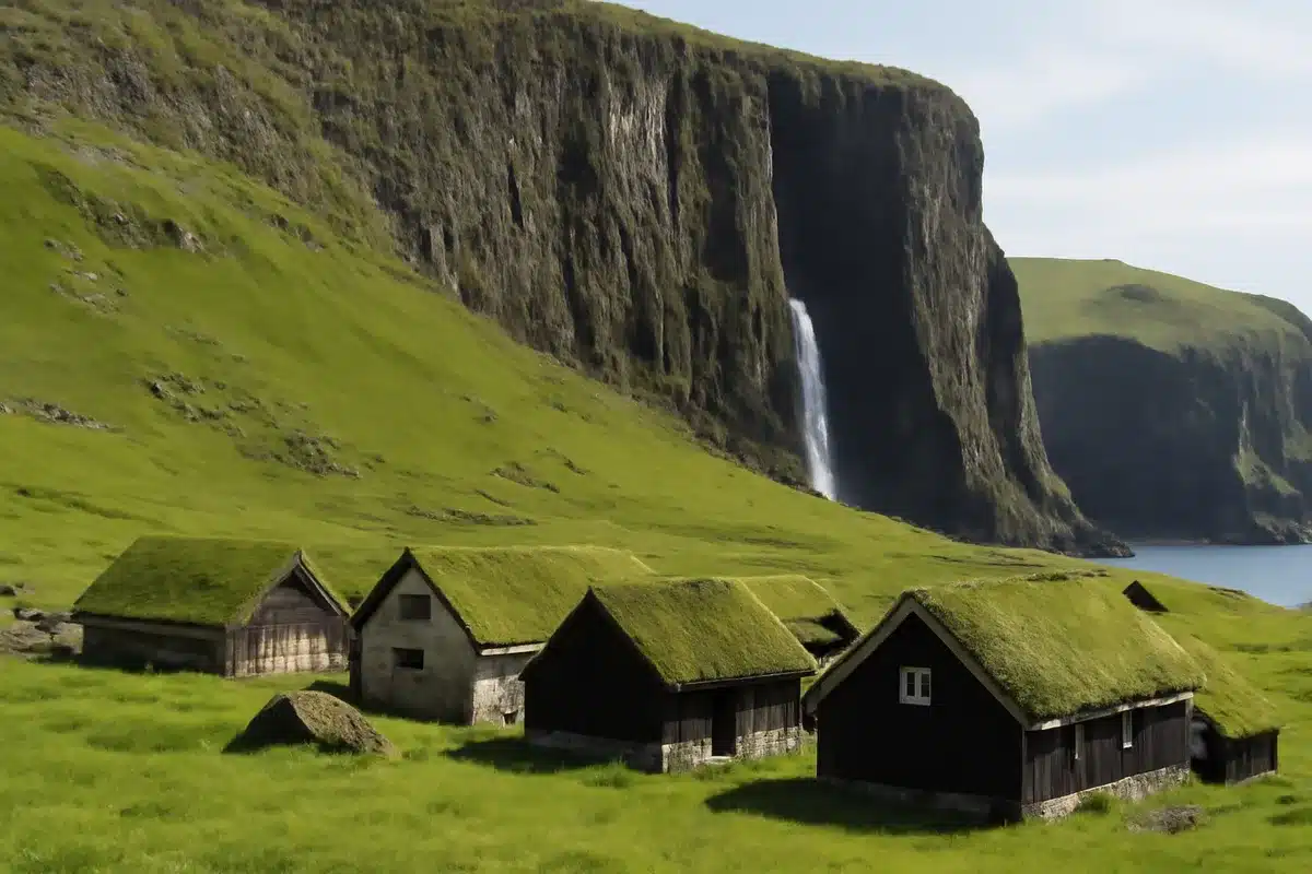
On the island of Vágar, the village of Gásadalur sits beneath sheer rock faces and houses topped with grass for insulation. Until the road arrived in 2004, residents relied on mountain paths to bring in mail, stoves and even coffins. “The postman used to walk here,” our tour leader Amalie tells me as we study the steep slope. “The Faroese are very, very hardy people.”
Faroe Islands: Europe’s hidden gem for spectacular hikes
How a coffee machine adds café-style luxury to your kitchen
The archipelago stretches between Iceland and Norway and comprises 18 islands. Their dramatic topography is the legacy of volcanic eruptions some 50 million years ago and later glaciation. The result is black basalt, jagged peaks and countless waterfalls carving the landscape — a setting locals sometimes call the “land of 10,000 waterfalls,” although there is no formal count.
Weather that shapes life
Conditions are often challenging. Locals say the islands see roughly 300 days of rain each year, and winds can reach about 23 miles per hour. Temperatures are tempered by the Gulf Stream: winters generally hover between -3°C and -6°C, while summers typically reach up to 16°C. “That’s a good summer – once in my lifetime it got to 18 degrees C,” our driver Pétur laughs.
Trails, lakes and cinematic draws
The Faroe Islands are a hiker’s destination. One of the most photographed spots is Sørvágsvatn on Vágar — a lake perched close to a cliff edge that creates an optical illusion of water hovering above the sea. My small tour group of nine, mostly solo travellers aged from their 30s to 70s, tackled a 7km route to the viewpoint. Despite the changeable weather, the clouds broke just as we reached the summit and the lake framed the ocean beyond with no other walkers in sight.
Other rewarding ascents begin from the tiny village of Gjógv on Eysturoy, home to an estimated 24 residents. From there a steep rise opens to views over a 200-metre sea gorge and a natural harbour where puffins also nest.
The hike to the Kallur Lighthouse on Kalsoy has become busier since it featured in the film No Time To Die; a memorial stone placed on the site has added to its notoriety. For those who prefer solitude, routes up Slættaratindur — the islands’ highest peak at 880 metres — offer broad panoramas when conditions allow.
Sea, food and livelihoods
Fishing remains central to the Faroese economy. The surrounding waters are rich in cod and salmon, and cod appears often on local menus. On a simple evening we ate pan-fried cod with locally grown potatoes — one of the few crops that thrive in these conditions.
Sheep farming also shapes the islands. There are roughly 70,000 sheep across the Faroes, outnumbering people and said to have been introduced by Irish monks around 500–600 AD. On a coastal farm called Heimablíðni, fifth-generation shepherds Harriet and John served lamb with creamed potatoes while their pet ram, Elias, grazed nearby. Rare Faroese horses — only about 104 remain worldwide — also roam the fields.
Infrastructure, small towns and traditions
A modern network of tunnels links most islands: 14 of the 18 are now connected, including an undersea junction that features a roundabout 70 metres below sea level. It is possible to use day trips from the capital to visit many of the islands.
Tórshavn, on Streymoy, contains about 40% of the national population of 55,000 but retains a compact, village-like atmosphere. Coffee shops, boutiques and a marina sit beside old wooden houses. Hotel Føroyar, set above the town, blends eco-conscious design with views over Nólsoy Fjord for guests willing to make the 20-minute uphill walk into town.
Local customs remain strong. I visited during the national celebration Ólavsøka, when people wear traditional dress — føroysk klæði — and the capital fills with chain dancing, communal meals and late-night singing. The Faroese language and cultural practices were preserved despite Danish rule from 1814 and a long history under Norwegian influence; Danish remained the official language until 1948 and was used in church services until 1938.
Community, safety and curiosities
The islands are known for low crime. A small, single-storey prison on Streymoy sits behind a modest fence and overlooks Mjørkadalur — the “valley of fog” — which is frequently shrouded in mist. “It’s for offences of less than two years — any higher and you’re sent to Denmark,” Amalie explains.
Driving the ribboning coastal roads reveals iconic features at nearly every turn: the Drangarnir sea stacks, two pointed islets that appear in the film How To Train Your Dragon, are one example. The place often feels slow and elemental. That pace, locals say, is part of its appeal.
Across the islands the human footprint is small but resilient. Communities remain closely connected to weather, sea and land — and to traditions that continue to shape everyday life on the Faroes.