
Search By Town
- Annascaul
- Ardfert
- Ballinskelligs
- Ballybunion
- Ballydavid
- Ballyferriter
- Ballyheigue
- Ballylongford
- Caherdaniel
- Cahersiveen
- Camp
- Castlegregory
- Castleisland
- Castlemaine
- Cloghane
- Dingle
- Dunquin
- Glenbeigh
- Glencar
- Kenmare
- Killarney
- Killorglin
- Listowel
- Maharees
- Milltown
- Portmagee
- Sneem
- Tralee
- Ventry
- Waterville
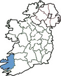
Search By Map
Holiday Accommodation
Glanteenassig Forest - Castlegregory *
Glanteenassig is a 450 ha. area of woodland, mountain, lake and peatland nestling in a sheltered valley among the Slieve Mish mountains. To reach it the visitor must step off the beaten track, travel up the valley and feel the remoteness of the mountains. Behind the trees the area abounds with streams, lakes, waterfalls and dramatic cliffs which characterise this untamed landscape. The wood is approached through a small grove of beech between the entrance and a bridge that spans the Owencashla river. Just over the bridge is a car park. The forest, typical of those which were established in the 1950's and 60's consists mainly of Sitka spruce and Lodgepole pine. However, there are some pockets of silver fir, larch and beech in the more sheltered areas and some native species such as birch, alder, and holly. As areas mature and are clearfelled much of the spruces are being replaced with larch, alder and Mountain ash in keeping with the primeval forests that once colonised the area. The first opportunity to experience the beauty of Glanteenassig is about 1.2 km from the car park. Just after crossing a wooden bridge, take a left along the trail to the shore of Lough Slat. This quiet and serene lake nestles below the imposing hill of Doon and the majestic rock face of Carrigaspanaig. This scene can be even more dramatic after heavy rain when "a thousand wild fountains rush down to that lake from their home in the mountains". ( J,J, Callinan ). It is easy to understand the origin of the name Glanteenassig or Gleann Ti an Easaigh which translates to the Valley of the Waterfalls. Back to the forest road and take the trail to the right which leads the visitor up along the bank of the river Owencashla and back on to the road again. Continue along the road to a T junction, take a left and after 100 metres you are on the shores of Lough Caum with a board walk right around the lake. This lake is a trout angler's paradise. From here the landscape opens up to a 360 degree vista of mountain, forest, lake and valley. Retrace your steps from here back to the T junction and continue on over a ford on the infant river travelling east for about 600 metres when suddenly the whole of Tralee bay with the Stack's mountains in the background comes into view. As well as the 3 waymarked trails there is about 8 km of forest road in this block of forest. This provides the ideal location for a long hike or for a family cycle. Although remote, Glanteenassig is only about 6 km from the sandy beaches at Castlegregory thus providing the perfect diversion for the holiday maker on the days not suited to the beach or when one tires of sun and sand. To get away from it all there is no better place to spend a day or even an afternoon.
Directions
Located 24 km west of Tralee off the N 86 at the village of Aughacasla.
Maps
Ordnance Survey Ireland Discovery Series: Number 70 and 71
Visit our bookstore to purchase this and other travel maps .....Ireland View Book Store
* Text; courtesy of Coillte Outdoors.
Castlegregory
Sorry there is currently no listings for Castlegregory.
Kerry Listings
To search for County Kerry listings please choose from the links on the left hand side of the screen. These links enable you to search by town, by area, by map or by a full listing. The links on the right hand side of the screen enable you to view County Kerry map, festivals, visitor attractions and other useful information.
Ireland View is constantly improving the service to our visitors to ensure that you enjoy your search on this site and find all the information you require to book your Irish Holiday. If you experience any difficulties please contact the Web Developer directly by clicking on the link in the Other Resources section.
Selection From Our Full Listings
Other Resources
Add to favourites
Contact Us
Add Your Business
Web Developer