Search By Town
- Annascaul
- Ardfert
- Ballinskelligs
- Ballybunion
- Ballydavid
- Ballyferriter
- Ballyheigue
- Ballylongford
- Caherdaniel
- Cahersiveen
- Camp
- Castlegregory
- Castleisland
- Castlemaine
- Cloghane
- Dingle
- Dunquin
- Glenbeigh
- Glencar
- Kenmare
- Killarney
- Killorglin
- Listowel
- Maharees
- Milltown
- Portmagee
- Sneem
- Tralee
- Ventry
- Waterville
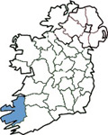
Search By Map

Holiday Accommodation
Lyracrumpane Wood - Listowel *
Lyracrumpane or Ladhar an Crompain which means the space between converging rivers is located in the Stack's Mountains of north Kerry between the Smearlagh river and the Crumpane river. The rivers converge just downstream from Lyracrumpane bridge. Lyracrumpane became famous in north Kerry and further a field for two reasons. The first was that in 1908 Matt Dillane from nearby Glountane while walking home from Listowel took a shortcut through "Quill's mountain" a mile from his home. He sat for a rest and fell asleep. He "awoke" to the sound of men working in the bog, houses, horses and a railway track complete with engine and wagons. He told his story often and earnestly but naturally nobody believed him. Matt died some 16 or 17 years later and his story continued to be recalled around many a winter fireside. In 1938 Matt's vision became a reality for the spot where he lay became the headquarters of the Lyracrumpane Bord na Mona works. There was an office, stores, a forge there and a diesel locomotive with 14 wagons brought turf from the bog to the roadside for waiting lorries. From 1938 to 1963 some 250,000 tons of peat was produced from this bog. A mural of Matt's vision painted by local man John Joe Sheehy now stands at the car park and picnic site. The second reason for Lyracrumpane's fame is that at nearby Reanagowan crossroads Dan Paddy Andy O Sullivan a famed matchmaker ran a dancehall and matched up many a couple. Dan Paddy Andy was the subject of John B Keane's book "The Man with the Triple Name" Folklore also states that Fionn Mac Cumhaill, chief of Na Fianna fell to his death in the Stack's mountains and is buried in Lyracrumpane. The total area of Coillte's woodland in Lyracrumpane is 574 ha. The Smearlagh river which means the river of the blackberries flows right through the property. A looped walk has been developed along the river bank and back by the public road which is called the Mass Path/ River Walk. A car park and picnic site is to be found along the loop walk. The area adjacent to the river is around 100ha. Some of this was planted in 1968 while the area closest to the river was planted in 1992.Tree species is mainly Sitka spruce but there are a few excellent stands of ash and beech near the river. The river has been designated a Special Area of Conservation (SAC) due to its importance as a salmon spawning ground.
Directions
From Castleisland take a secondary road signposted for Listowel. Travel 12 km's along a scenic road through forest and bog land to the 4 Elms Bar on your left. On the way you will have passed through Reanagowan crossroads, famous for Dan Paddy Andy's dancehall.
Maps
Ordnance Survey Ireland Discovery Series: Number 71
Visit our bookstore to purchase this and other travel maps .....Ireland View Book Store
* Text; courtesy of Coillte Outdoors.
Listowel
Sorry there is currently no listings for Listowel.
Kerry Listings
To search for County Kerry listings please choose from the links on the left hand side of the screen. These links enable you to search by town, by area, by map or by a full listing. The links on the right hand side of the screen enable you to view County Kerry map, festivals, visitor attractions and other useful information.
Ireland View is constantly improving the service to our visitors to ensure that you enjoy your search on this site and find all the information you require to book your Irish Holiday. If you experience any difficulties please contact the Web Developer directly by clicking on the link in the Other Resources section.
Selection From Our Full Listings
Other Resources
Add to favourites
Contact Us
Add Your Business
Web Developer

